Rooftop 3d - visuals from the advanced Lidar rooftop calculator I developed using .las files and ESRI ArcPro Model Builder, for use in the roofing industry.
ground truth between aerial lidar point cloud (pictured here) and architect drawing for the Rooftop 3D program
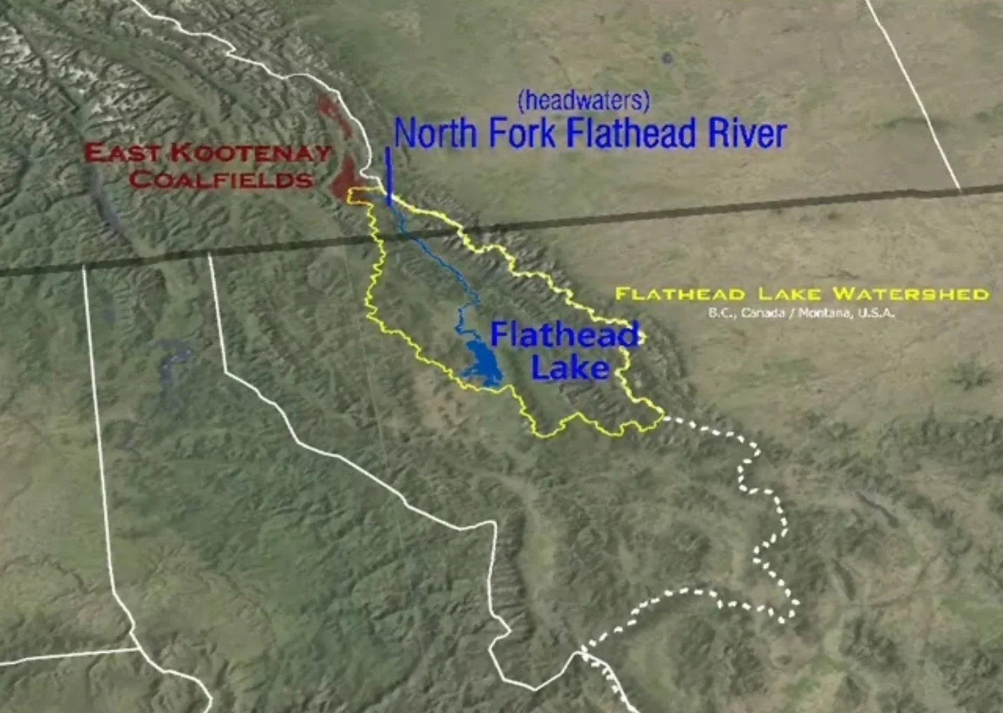
This video provides its audience with a spatial reference for the state, provincial, federal, and international land use designations that have protected the ecological integrity of the transboundary flathead watershed for the past 100 years.
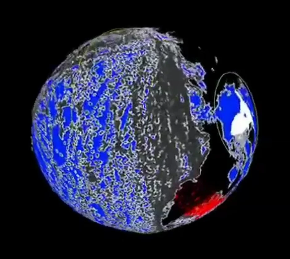
I assembled this narrated animation for an Earth Day contest to highlight some of the environmental and social costs associated with globalized consumerism (use audio - Narrated).
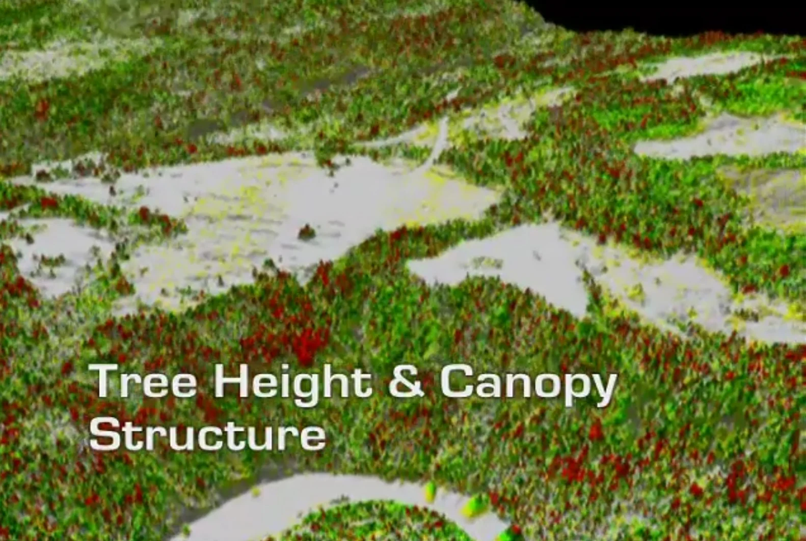
I created the rasters datasets shown in this video from Lidar point clouds. This animation was designed to highlight the spatial analysis capability of the environmental consulting firm I worked for. (Jacques Whitford - AXYS)