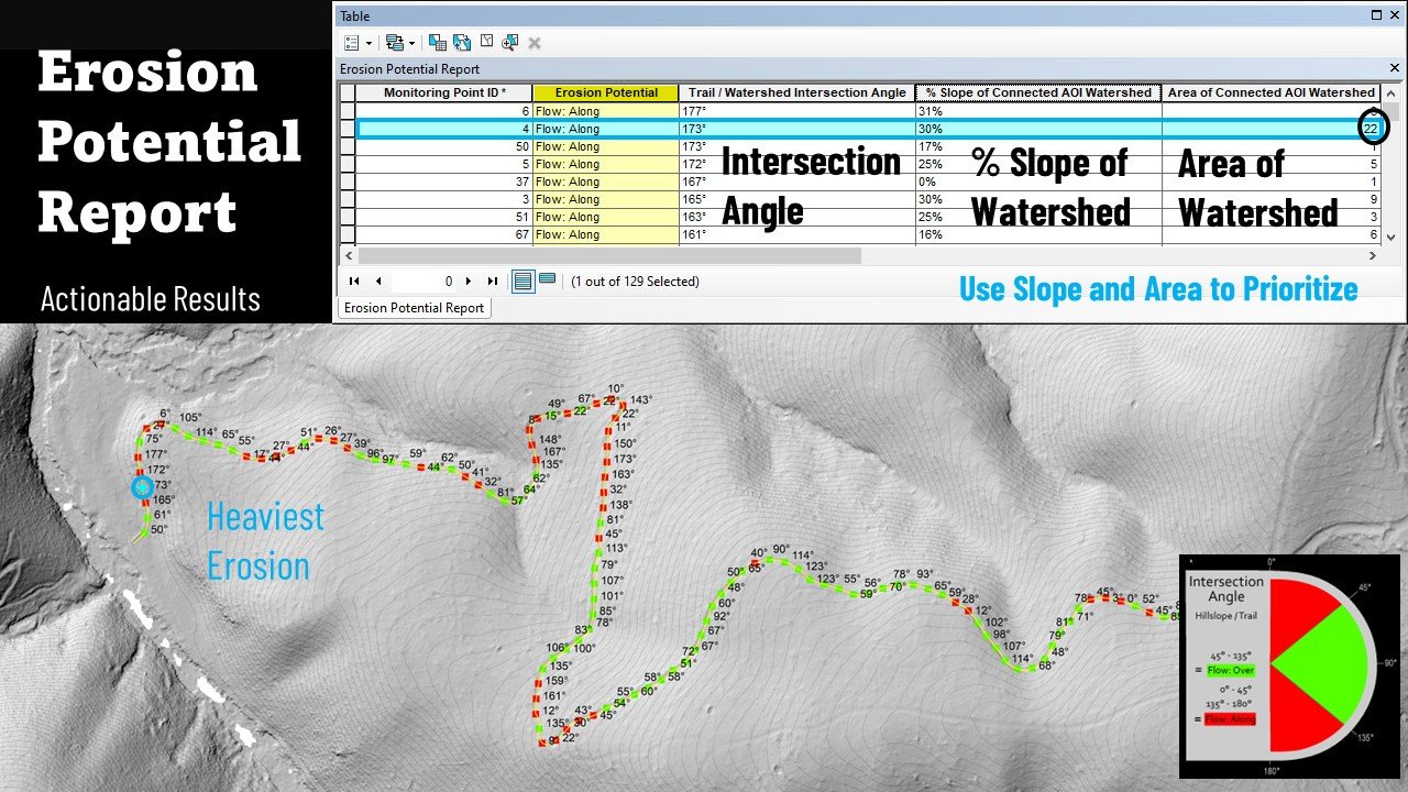
Do you need clear and actionable information of where potential waterflow will erode your linear network? Learn how the Erosion Potential Model saves you time and money by revealing the erosion fate of every monitoring point along any length of trail, road, or fireline etc.Demo an Erosion Potential Report (EPR)
A successful Erosion Potential Report starts with alignment between linear asset and Lidar DEM.


The erosion fate of every monitoring point in your network is revealed in our comprehensive, easy to use interactive mapping platform.